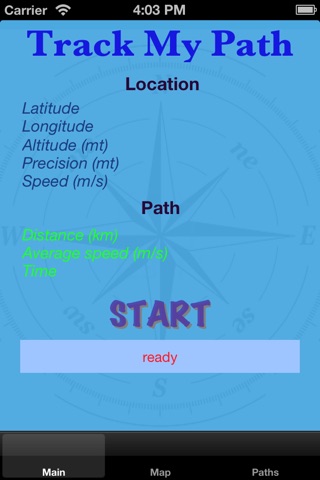


Track my Path app for iPhone and iPad
Developer: Giuseppe Congiusta
First release : 10 Dec 2012
App size: 5.7 Mb
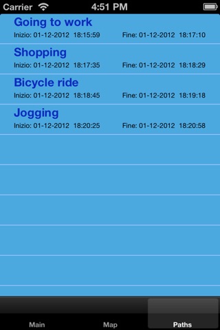
You are on holiday on the mountains or you are participating in a Safari? Why with the pictures of the trip dont you also save the track of the route in which you have ventured?
Or you have a passion for jogging or marathons and you want to share or just keep for your memory the track of the location in which you have ran with indication of: gait average, time required, and of course the mileage?
Or you are a professional or a sales agent who spend most of the day in a car and you may want to remember the path you have traveled, for example to justify in front of your boss the request mileage reimbursement :-)?
So in these kind of situations, and in all those where you want to save on a map the route you have traveled (if only for fun), Track My Path can do for you.
Some instructions for use:
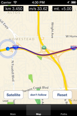
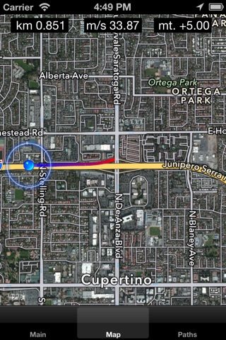
1) This application uses the native map kit of your iPhone so depending on the IOS version you have installed on your device, the maps will be those of ios 6 or those of the previous versions. Note: the maps are downloaded in real time so an active internet connection is required
2) the way youre walking on will be drawn on the map by exploiting the GPS precision of your device. But be careful: if you spend most of your day in a subway or you are a cavers or for fear of breaking your iPhone, you armored it with a concrete and titanium exoskeleton :-) ....Have I to tell you? it would be nice but in some scenarios the GPS, as you know, does not work very well. But for the vast majority of cases go quiet, and try this app. And what I tell you to do? It s free ..... however if you are convinced you dont need it, the bin is there for this :-), but Im sure that once tasted, you can not do without worry :-) quiet, not addictive.
Note: prolonged use of the GPS cause a greater reduction of the battery charge
3) The application is very easy to use and does not require much instruction manuals; it is very intuitive if only because all of you are already skilled with the iPhone maps and you know perfectly well, how you can scroll the map, increase / decrease zoom or simply change the map style passing between a map view / hybrid / satellite.
There is only one function that might escape and therefore requires an explanation:
I did not want too many buttons to cover the map, risking deturparne his style, so I decided to use a feature of the iPhone ie the ability to recognize the long touch. So beware: some buttons are hidden but they will be displayed after a simple long touch on the map; it comes to some aspects of which we spoke above (choosing the style map, cleaning path and Follow. The last in particular allows you to enable / disable the centering of the map on the user location, useful function in all cases in which you want to scroll the map to give a look around)
4) That s all folks, so try it and send me your feedback